NorCal Aerial is your premiere provider of aerial photography, videography, data capture and more in Northern California using drones and manned aircraft.

Gain New Perspective

Drone and aerial imagery provides beautiful photos and video, providing a perspective that can only be gained from the air. Our team at NorCal Aerial can go further and show more with a wide variety of aerial data capture services, including roof inspection, construction monitoring, infrastructure inspection, vegetation and crop health, orthomosaic imagery/modeling & traffic analysis.

  • Generic placeholder image
    Creative Photo & Video
    Commercial & Residential real estate, weddings & live events, ranch and livestock and more. The sky is no longer the limit.
  • Generic placeholder image
    sUAS (Part-107) Training
    On-site, on-line and hosted classroom training prepares you or your employees to utilize drones and aerial imagery in commercial enterprises to solve complex business challenges.
  • Generic placeholder image
    Data Capture
    3D mapping, builing and construction monitoring, insurance assessment, infrastructure & traffic analysis and more. Attain a higher level of analysis and accuracy.
Latest Work

Samples of some of our recent work

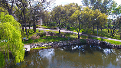
Wedding Photograhy Site

Stills and video to promote a idealic ranch location for engagement and wedding photos

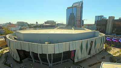
Video Promotion

Stills and video to promote underrepresented voters at large venue advertising locations.

GET TO KNOW US

A commercial, instrument-rated pilot for manned aircraft flying drones professionally since 2017, I am also a sUAS qualified instructor pilot for the Civil Air Patrol.

GET IN TOUCH

NorCal Aerial
Sacrmento, California
916.800.4077
fly@norcalaerial.com

GET SOCIAL

Visit NorCal Aerial on Facebook Visit NorCal Aerial on Twitter Visit NorCal Aerial on Yelp Visit NorCal Aerial on Instagram Visit NorCal Aerial on YouTube